


Geotagging+

Geotagging+ açıklaması
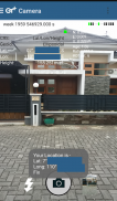
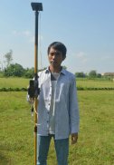
This app allows you to take image and measure with low-cost GNSS module (like U-blox GNSS module or E-GNSS from potretudara : http://www.potretudara.com/low-cost-gps-gis/ ). Measured coordinates from low-cost GNSS module are stored to EXIF image metadata in time when you tap the "capture" button. Use this to create your geotagging more precise to sub-meter level. Very useful for census, GIS support, reporting issue, and others.
You can still use internal GNSS for geotagging by deactivate BASE and ROVER in the Input Stream menu. Obviously none of the precision algorithm found in RTKLIB can be use.
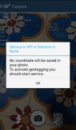
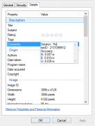
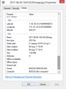
Image taken by this app will have coordinate metadata, accuracy, and solution type (internal, single, float, or fix).
Heavily based on RtkGps+ from Ronan LE MEILLAT, this is a fork of his work. Original licenses are in the "About/Legacy Info" screen. Thanks to all contributors to respect this clause.
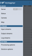
This app is RTKGPS+-like with additional Camera menu. You still can use this app for surveying, tracking, etc. like RTKGPS+ do.
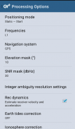
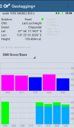
This app is a port of RTKLIB 2.4.3b 28 developed by Tomoji Takasu (http://http://www.rtklib.com/). This RTKLIB 2.4.3 is modified by rtklibexplorer and named RTKLIB 2.4.3 demo 5 b 28 (https://github.com/rtklibexplorer/RTKLIB). If you do not know what this application is, this application is probably not what you are looking for!
App manual : http://bit.ly/shortmanual
Bu uygulama, görüntüyü alıp (: http://www.potretudara.com/low-cost-gps-gis/ potretudara U-blox GNSS modülü veya E-GNSS) gibi düşük maliyetli GNSS modülü ile ölçebilirsiniz. düşük maliyetli GNSS modülünden ölçülen koordinatlar siz "yakalama" düğmesine dokunun zaman içinde EXIF görüntü meta verilerine saklanır. alt metre seviyeye coğrafi etiketleme daha kesin oluşturmak için bunu kullanın. nüfus sayımı, CBS desteği, raporlama sorununu, ve diğerleri için çok yararlı.
Hala Girdi Akış menüsünde devre dışı bırakmak BASE ve ROVER tarafından geotagging için iç GNSS kullanabilirsiniz. Açıkçası RTKLIB bulunan hassas algoritmasının hiçbiri kullanmak olabilir.
Bu uygulama tarafından alınan görüntü meta, doğruluk ve çözüm tipini (iç, bekar, şamandıra veya düzeltme) koordinat sahip olacaktır.
Ağır Ronan LE MEILLAT gelen RtkGps + dayanarak, bu eserinde bir çatal. Orijinal lisansları "Hakkında / Eski Bilgi" ekranında içindedir. Tüm Katkıda bulunanlara teşekkürler bu maddeyi saygı.
Bu uygulama, ek Kamera menüsü ile RTKGPS + -like olduğunu. Hala + yapmak RTKGPS gibi, vb ölçme takibi için bu uygulamayı kullanabilirsiniz.
(: // http: //www.rtklib.com/ http) Bu uygulama Tomoji Takasu tarafından geliştirilen RTKLIB 2.4.3b 28 bir liman. Bu RTKLIB 2.4.3 rtklibexplorer tarafından değiştirilen ve RTKLIB 2.4.3 demo 5 b adlandırılır 28 (https://github.com/rtklibexplorer/RTKLIB). Bu uygulama ne olduğunu bilmiyorum, bu uygulama aradığınızı muhtemelen değil!
Uygulama kılavuzu: http://bit.ly/shortmanual


